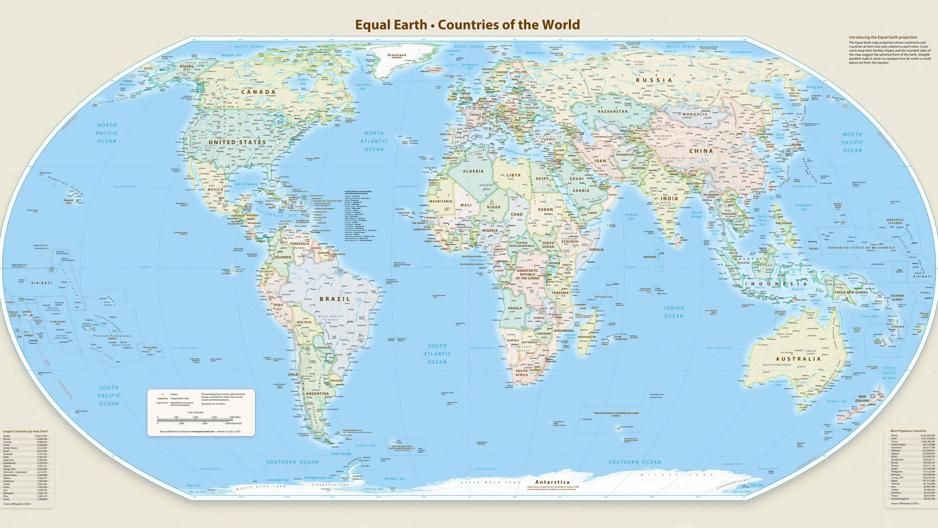
Eine neue Weltkarte soll zeigen, wie groß Afrika und andere Kontinente tatsächlich sind.
APA-Images / AFP / Equal Earth
*** HANDOUT *** This handout graphic provided by Equal Earth shows the Equal Earth cartographic projection. The United Nations General Assembly voted on September 4, 2026, to back a resolution spearheaded by several African countries to adopt a map that makes their continent bigger while shrinking North America and Europe. Aimed at "a more accurate representation" of continental landmasses, the resolution was supported by 164 countries while the United States voted against it and six other states abstained. The new map -- known as the Equal Earth cartographic projection -- "is a relevant option for improving the accuracy of the cartographic representation of the world," the resolution said. (Photo by Handout / Equal Earth / AFP) / RESTRICTED TO EDITORIAL USE - MANDATORY CREDIT "AFP / EQUAL EARTH / HANDOUT " - HANDOUT - NO MARKETING NO ADVERTISING CAMPAIGNS - DISTRIBUTED AS A SERVICE TO CLIENTS